

The METAR tells you what was true at the airport an hour ago. The clouds you can see right now tell you what's true in the next ten miles. For helicopter pilots — who often fly low enough that the cloud bases are above us instead of below us — that visual information is the difference between an enjoyable flight and a chiropractor visit.
Cumulus: shape tells you about the air below
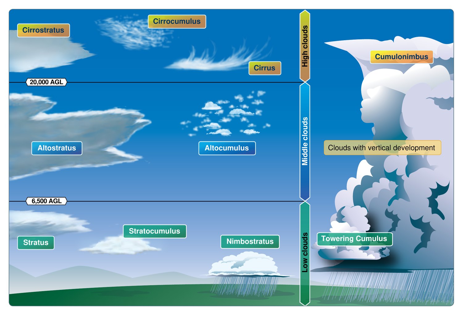
The base of a cumulus is, by definition, the dewpoint level — that's where lifting air cools to saturation. The vertical development above that base is a thermometer for how unstable the layer is.
- Flat, scattered cumulus humilis — fair-weather cu. Bumpy on climbout, smooth above. Stable atmosphere with shallow surface heating.
- Tall, cauliflower-headed cumulus congestus — moderate to severe turbulence below the base. Active updrafts and downdrafts, often 1,000–2,000 fpm. Unstable, deep layer.
- Cumulonimbus — turbulence inside it, hail aloft, microbursts below. The 20-NM rule isn't superstition.
If a cumulus has crisp, hard-edged outlines, the updrafts feeding it are vigorous. Fuzzy, dissipating edges mean the cell is decaying — bumpy, but the worst is past.
Lenticular clouds — the mountain wave billboard
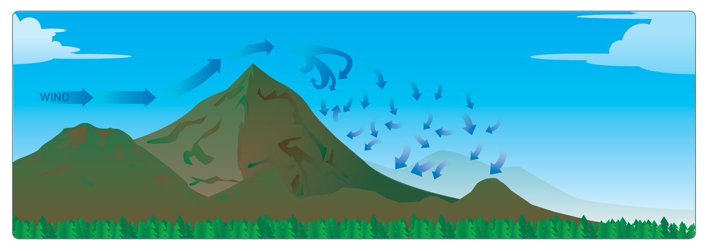
A standing lenticular (ACSL on the chart, or "lennie" in conversation) is the visible top of a mountain wave's crest. The cloud sits still while the air rushes through it. What this tells you:
- The wind aloft is strong and roughly perpendicular to the ridge.
- The atmosphere is stable enough to support standing waves.
- There is severe turbulence in the rotor below — sometimes by an order of magnitude worse than the smooth-looking lennie above.
The lennie itself is often glassy-smooth to fly through. The trap is the rotor cloud below it — ragged, tumbling, often invisible if humidity is too low to make it visible. A clean lenticular without a visible rotor is not the same as a benign rotor.
Rotor clouds — the part you're actually worried about
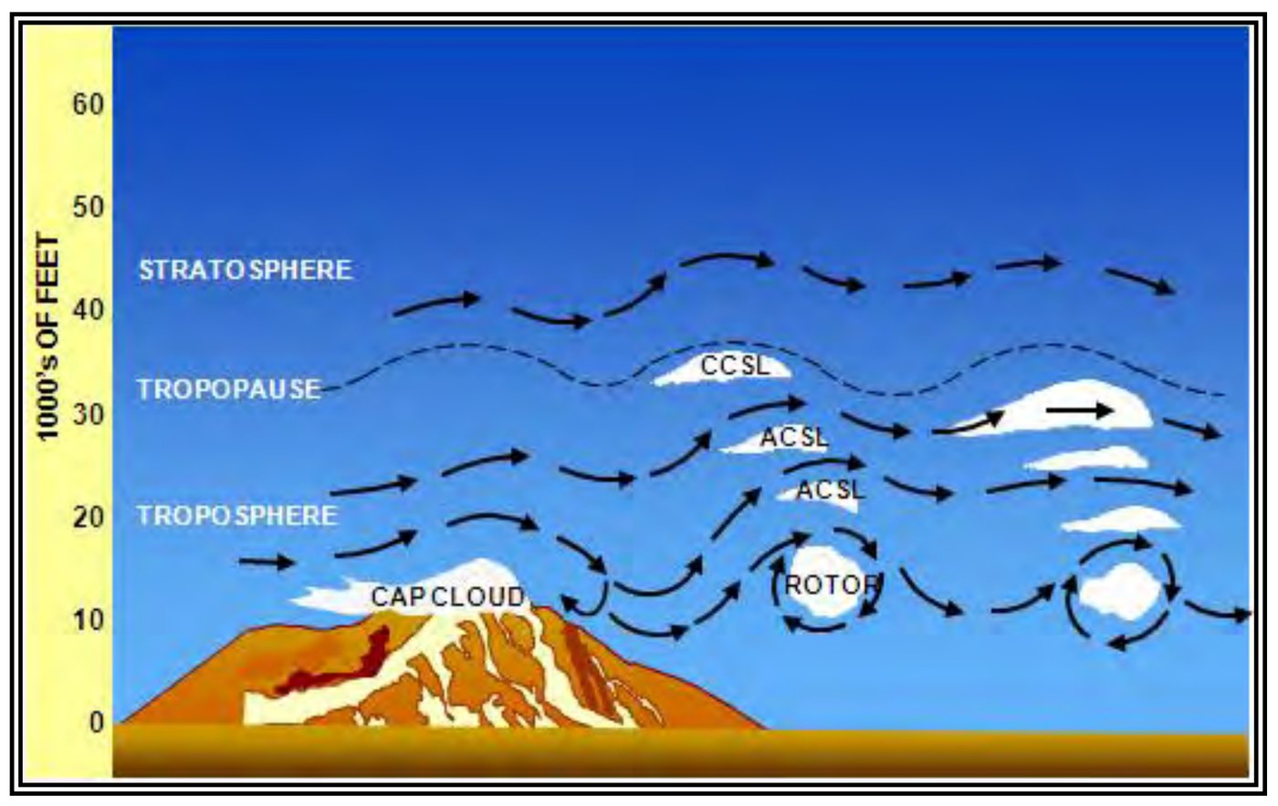
Rotor clouds form on the lee side of a ridge under wave conditions, typically below ridge height. They look ragged, irregular, and they tumble in time-lapse. PIREPs from this layer routinely contain "severe" and "extreme" — and helicopters in this layer routinely contain bent metal.
If you can see a lenticular and you cannot see what's below it, assume rotor turbulence and route around. The rule of thumb is to add 50% to the ridge height for your minimum altitude on the lee side, and to cross at 45° so you have an out.
Further reading
The ragged base
Stratus or stratocumulus with a ragged, scuddy base is telling you about wind shear underneath it. Smooth, level cloud bases mean the air is smoothly stratified. Ragged, torn-looking bases mean the air below is being mechanically chopped — usually by terrain interaction or by gust fronts pushing under the layer. For a low-level helicopter route, a ragged stratus base is a more immediate concern than a high cumulus deck.
What this gets you
Pre-flight, you read the forecast and the winds aloft and you make a plan. In flight, the clouds tell you whether the forecast was right. If you launched expecting a smooth ride and the cumulus over the ridge has gone from humilis to congestus in the last hour, the atmosphere is telling you to land somewhere and wait. That's a free PIREP, written in water vapor, available from the cockpit at no cost.
Helicopter pilots have an advantage here that fixed-wing crews don't: we can land. Use it.